Articles by author: sjanzen

  • Celebrate GIS Day with us!

    During Geography Awareness Week 2026, the Brock Library will be celebrating Geographic Information Systems (GIS) in a few unique ways and you are invited!

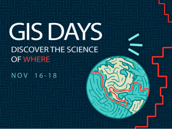
    Take part in a free virtual conference hosted by Western University Libraries and sponsored by academic institutions and affiliates across the country! The conference which runs Monday, November 16 and Tuesday, November 17 is composed of a plenary speaker, Seth Guikema, from Canada’s Severe Storms Lab, 7-minute lightning talks highlighting the use of GIS in research and special projects, a GIS Career Panel discussion, and a loosely-themed geography Trivia Night! There will be prizes galore during the conference.

    The fun continues on Wednesday, November 18th when we will be offering FREE CAKE & PIZZA as well as a GIS resume-writing and award opportunity workshop. Visit our GIS DAYS storymap for more details.

    Register for GIS Days now. We hope to see you there!

    Contact Sharon Janzen, [email protected] for more information.


    Tags: , ,
    Categories: Main, MDGL

  • Maps & GIS Services at Brock Library

    When you think of your courses, is there a geospatial component to them? Do you encourage your students to push the boundaries of their learning experiences at Brock? Do you ever think “Maybe, but I don’t know how?” Whether you are a seasoned faculty member, an LTA or a grad student, I am here to help with geospatial technologies. My name is Sharon Janzen and I am the Maps, GIS & Geospatial Data Specialist at Brock University. I offer services that include custom mapping, collaborative teaching, technical support for Esri products including ArcGIS Pro, ArcGIS Online and ArcGIS StoryMaps. With specialized expertise in geospatial workflows, traditional maps, and research-focused teaching, I help you turn geographic questions into meaningful, visually compelling results.

    Contact me today to discuss your teaching and research interests.  
    Sharon Janzen, Maps, GIS & Geospatial Data Specialist 
    [email protected]


    Read what other users have to say about GIS services at Brock Library:  

    • From Marilyne Carrey, Associate Professor, Environmental Sustainability Research Centre 

    “Sharon has been an invaluable partner in my teaching and research, bringing exceptional expertise in GIS, remote sensing, and geospatial data. Her engaging workshops, collaborative spirit, and infectious enthusiasm for mapping make her an extraordinary asset to both students and faculty.”  

    • From Dave Brown, Associate Professor, Dept. Of Geography and Tourism Studies   

    “Sharon has been our Brock go-to person for all things geospatial! Recently she assisted us with the creation of a series of juxtaposed historical and contemporary street maps which effectively visualize the evolution of a historic Niagara neighbourhood over more than a century. Not only does she provide theoretical and practical guidance and assistance, she also gets involved in a hands-on manner to help us produce useful, interesting, and informative map resources.”  

    • From Leah Knight, Professor, English Language & Literature 

    “Sharon Janzen’s generous and informed support has been a lifeline for my current map-based research, which takes me outside my traditional comfort zone in terms of both methods and materials. Whether working with faculty, students, or the community, Sharon wears her expertise lightly, so that even an amateur can feel comfortable and learn with ease. Sharon goes well out of her way to connect researchers with the resources they need—including those they might not know about if it weren’t for her. She is unfailingly positive and solution-oriented, no matter what thorny problem is brought her way. I feel lucky to have discovered the wealth of wisdom Sharon brings to Brock. “  

    Tags: , , , ,
    Categories: Main, MDGL

  • Brock Library collaboration featured in new Lincoln Museum exhibit 

    Brock Library is proud to have contributed to the Lincoln Museum’s newest exhibit, Through the Grapevine: Winemaking in Niagara, which opened on Thursday, October 30th in Jordan, Ontario. The exhibit explores the rich history of winemaking in the Niagara region—from its early roots to the thriving industry it is today—and will be on display through to October, 2026.

    As part of this collaboration, Sharon Janzen, Brock’s Maps, GIS & Geospatial Data Specialist, created a detailed map illustrating Niagara’s wine sub-appellations, highlighting the geography that shapes the region’s distinctive wines. Complementing the map, Derek Schneider, Makerspace Manager, developed a 3D model of the mapped area designed as an interactive puzzle, allowing visitors of all ages to assemble the terrain piece by piece.

    This project showcases how Brock Library supports and celebrates local heritage through innovative uses of spatial data, design, and technology. It also highlights the creative possibilities that emerge through campus and community collaboration.

    Interested in exploring partnership opportunities or learning more about what we do? Get in touch at [email protected].

    Tags: , , ,
    Categories: Main, Makerspace, MDGL

  • Big changes coming to the Map, Data & GIS Library this spring

    Starting April 28, 2025, the Map, Data & GIS Library will be shifting to a by-appointment-only service model. This means that if you need access to our collections or staff expertise, you’ll need to book an appointment in advance by emailing [email protected].

    This new model will be in place throughout the next academic year and will be reassessed for the Fall 2026. Our goal is to provide more personalized support while ensuring that we continue to meet the needs of our users effectively.

    If you have any questions or concerns, please don’t hesitate to reach out – we’re here to help!

    Contact us: [email protected]

    Tags:
    Categories: Main, MDGL

  • Annual GIS scholarship returns to Brock

    Attention all Brock GIS users! It’s time for the annual Esri GIS Scholarship Competition. Eligible students (current students from undergrad to grad) can submit a ~500 word ESRI GIS project proposal with their resume to [email protected] by April 21st at 11:59 PM.

    Geographic Information Systems is mapping and analysis software. Esri is the industry standard for GIS across all sectors. GIS is used at Brock in Health Sciences, Biological Sciences, Environmental Sciences, History, Literature & Language, Political Science, Earth Sciences, Recreation and Leisure Studies and Geography/Tourism.

    The deliverables for the successful candidate will include a poster and report in the form of an Esri StoryMap due by June 1, 2025. Prizes include $1,500 cash, software access, books, networking opportunities and more!

    Details: https://scholars.esri.ca/profile/?uid=Brock%20University
    Student FAQ: https://scholars.esri.ca/students/faq-students/

    Submissions and questions should be directed to Sharon Janzen, [email protected] in the Map, Data & GIS Library, MC-C306

    Tags:
    Categories: Main, MDGL

  • MDGL is Open!

    The Map, Data & GIS Library (MDGL) would like to welcome back the Brock community for the academic year 2024-2025! After being open By Appointment Only, we will return to our regular working hours of 9 a.m. to 4 p.m. Monday through Friday. The MDGL will remain closed for weekends, holidays and intercession.  Reading Week hours will be By Appointment Only.

    Email [email protected] for more information.

    The MDGL offers study space, computers, knowledgeable and friendly staff to assist with finding and using our cartographic collections including maps, atlases, books, digital air photos and more! We look forward to serving you.

    Welcome back, Badgers!!!

    Tags: , ,
    Categories: Main, MDGL

  • Exam supports: Map, Data & GIS Library

    Looking for some quiet study space? The Map, Data & GIS Library is open 9-4 Monday to Friday and hosts a number of public PCs plus large tables for group study or comfy chairs for individual study. You do not need to reserve a desk or table and all are welcome to use our space!

    Coming soon…. an ‘unstudy’ table with puzzles, colouring pages, and origami to provide necessary distractions leading to reduced stress and healthy minds.

    Here’s how to find us. See you soon, in the MDGL! Mackenzie Chown Complex, C306.

    Tags: ,
    Categories: Main, MDGL

  • GIS scholarship opportunity

    Attention all Brock ArcGIS users! It’s time for the Annual Esri Scholarship Competition. Eligible students (current students including undergraduate to graduate with B+ Major average) are invited to submit a ~500 word Esri GIS Project Proposal with their resume to [email protected] by April 1st 4:30 p.m. A nominee will be announced by April 15th with project deliverables due by June 1st. The deliverables for the successful candidate will include a poster and report in the form of an Esri StoryMap. Prizes include $1,000 cash reward, software access, books, conference passes and more!

    Esri is the industry standard for Geographic Information Systems (GIS) across all sectors. GIS is used at Brock in Health Sciences, Biological Sciences, Environmental Sciences, History, Literature & Language, Political Science, Earth Sciences, Recreation and Leisure Studies and Geography/Tourism.

    More details: https://scholars.esri.ca/profile/?uid=Brock%20University
    Student FAQ: https://scholars.esri.ca/students/faq-students/

    Submissions and questions should be directed to Sharon Janzen, [email protected] in the Map, Data & GIS Library, MC-C306

    Tags: , , , ,
    Categories: Main, MDGL

  • GIS Day Buzz

    Wednesday, November 15th marks a special day in the geography world as we gear up to celebrate GIS! Geographic Information Systems (GIS) combines software, hardware, data and people to create, analyze and disseminate geospatial data and ideas about where and why things happen as they do. Join us this year to learn more about GIS and specifically ArcGIS, the industry standard for mapping technology. The Map, Data & GIS Library is hosting a variety of events including:

    Wednesday, November 15, 2023

    10-11:30 a.m. GIS for Faculty and Staff: A 90 minute workshop introducing attendees to the Esri site license and ArcGIS software options for research, teaching and administrative tasks. Registration recommended.

    12-1:15 p.m. Pizza & Cake in the MDGL: Join the Tourism and Geography Society (TAGS) for lunch in the MDGL where anyone can buy a slice of pizza ($$) and partake of the infamous GIS Day cake (free)!

    1:30-3:30 p.m. GIS for Brock Community: This 120 minute session will introduce students, faculty and staff to GIS with a hands-on component. Attendees should bring their own device to engage fully with the session. Registration recommended.

    Further to the Brock GIS Day festivities, interested parties can take advantage of the FREE online GIS Days Conference hosted by Western University Libraries. The conference runs from Nov. 13-16, 2023. Check out the schedule and register today!

    Brock representations at the GIS Days conference includes:

    Tuesday, Nov. 14, 12:30-1:30 p.m. Introduction to ArcGIS Online by Sharon Janzen

    Thursday, Nov. 16, 11 a.m. HGIS Lightning talk by Rebecca Nickerson

    Questions? Contact [email protected] (Map, Data & GIS Library, MC-C306)

    Tags: , , ,
    Categories: Main, MDGL

  • GIS Day is coming …

    It’s that time of year again when we start planning for GIS Day! November 15th will mark this eventful day for all users of GIS technologies. We will have presentations, contests and displays as well as tutorials, pizza ($$) and CAKE (FREE!). Please mark your calendars for Wednesday, November 15, 2023 and stay tuned for details.

    GIS stands for Geographic Information Systems and broadly represents the technology behind analyzing and creating map products. There are many departments using geospatial technologies for research and teaching at Brock University: Geography & Tourism Studies, Earth Sciences, Health Sciences, Political Sciences, History, Modern Literature & Languages, etc. If you haven’t tried giving a spatial context to your work, perhaps it’s time to explore the options available.

    Follow us on Instagram for up-to-date information.


    Tags: , ,
    Categories: Main, MDGL