- Main
- About Us
- Welcome
- Hours
- Staff
- Strategic Plan (PDF)

- Policies
- Borrowing Policies
- Code of Conduct
- Collection Development Policy
- Computer Laptop Lending Policy
- Computer Access Policy
- Correspondence Policy
- Food and Drink Policy
- Guidelines for the Appropriate Use of Library Workstations
- Inclement Weather Policy
- Information Literacy/Library Research Skills Policy
- Photography & Filming Policy
- Privacy and Protection of Information
- Reserve Collection Policy
- Study and Work Space
- Interlibrary Loan Policies
- Library Access for the Local Community
- Library Donation Policy
- Personal Belongings Guidelines
- Matheson Learning Commons

- Newsletter
- Support the Library
- Open Access
- Research
- Services
- Collections
- Help
- Copyright
Outline Maps
James A. Gibson Library
Outline Maps
These outline maps were prepared by Map Library staff and are FREE to download. These files can be modified in Adobe Illustrator. Click a title to view and download a map in Adobe PDF format.
Copyright:These maps are free to download and use "as is" or modify as required for your purposes. See below for appropriate citation formats.
Local
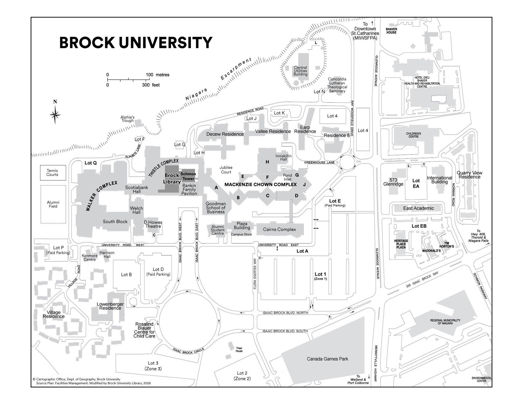
- Brock University Campus Map
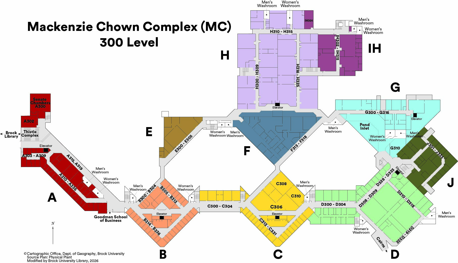
 - Campus Libraries
- St.Catharines
- St.Catharines: DOWNTOWN AREA
- St.Catharines Brock University Students 2002
- St.Catharines Brock University Students 2002: Glenridge Ave. and Environs
- St.Catharines Brock University Students 2002: Thorold Area
- St.Catharines Brock University Students 2002: Downtown Core
- Niagara Peninsula
- Niagara Region Municipal Boundaries
- General Physiography of the Niagara Peninsula
Ontario
- Peterborough
- Peterborough, Ontario
- Peterborough and Surrounding Area: Bedrock Geology
- Peterborough and Surrounding Area
- Warsaw Caves Conservation Area
- Mark S. Burnham Provincial Park Area
- Ontario Cities
- Ontario-Regional Municipalities, Counties & Districts
- Ontario (no names) (PDF 194 kb)
- Southern Ontario-Regional Municipality Boundaries
- Southern Ontario
North America
- Canada (polygons)
- Canada
- Canada (no names)
- Canada (major waterbodies)
- Canada (French version)
- Atlantic Canada
- Central Canada
- Canada - Prairie Provinces
- Western Canada
- Northern Canada
- USA cities
- USA (no names)
- Central America
World
Other Areas
Sample Citation Format sample: St.Catharines Outline Map
St. Catharines [computer file]. (no date). St. Catharines, Ontario: Brock University Map Library. Available: Brock University Map Library Controlled Access http://www.brocku.ca/maplibrary/images/stcathv8.jpg. (Accessed May 24, 2005).
OR
Modified from: St. Catharines [computer file]. (no date). St. Catharines, Ontario: Brock University Map Library. Available: Brock University Map Library Controlled Access http://www.brocku.ca/maplibrary/images/stcathv8.jpg. (Accessed May 24, 2005).
| Quick Search |


