Articles from:October 2020

  • Wetlands: Our natural flood protection partner

    Niagara Peninsula Conservation Authorities E.C. Brown Wetland Restoration site in South Pelham with Katleya Young-Chin, Ecosystem Restoration Specialist.


    Wetlands are among the most biologically diverse ecosystems on Earth, supporting well over 100,000 species globally. Humans rely on this diversity for a wide range of goods and services (known as ecosystem services), and wetlands are important for the social, economic and ecological health of our country.

    Despite their obvious contributions, however, more than 87 per cent of our global wetlands have been lost, primarily due to land conversion, invasive species and climate change. Southern Ontario, the most biologically diverse life zone in Canada (home to over 2,500 species of plants and animals), has lost over 90 per cent of its original wetlands due to urbanization and agriculture. As one quarter of all the wetlands in Canada are found in Ontario, their disappearance in the province has had a significant impact and been associated with increased flooding as well as the deterioration of wildlife biodiversity and water quality.

    Wetlands play a significant role in climate change mitigation and adaptation, by helping to reduce and prevent flooding. Acting as natural “sponges,” wetlands capture and slowly release water back into the environment after rain events. Since our human-made infrastructures (buildings, roads, parking lots) are not permeable, water will quickly “runoff” to the nearest low point. In urban settings, that runoff usually flows to storm drains, and most of those drains then directly discharge in creeks, rivers or lakes. This fast transfer of water (stormwater runoff) can quickly overwhelm creeks, rivers, and stormwater systems and when excess water has no place to go, flooding happens. Contrary to the common belief, quickly moving water off the landscape will not reduce flooding, it actually increases it. Too much water in such systems leads to blockage and back-up (including in houses).

    To illustrate how flooding can happen in urban areas, consider an average sized house which typically generates approximately 2,000 litres of runoff during a typical rain event. This is about the equivalent of 150 bathtubs full of water. In Niagara, with close to a quarter of a million dwellings, this is the equivalent to filling 1.7 million bathtubs, or 100 Olympic swimming pools, with stormwater.

    Niagara and its surrounding areas have seen significant wetland losses, currently approaching 90 per cent. That losss, coupled with the increased storm frequency and intensity caused by climate change, is causing large volumes of stormwater to be generated which is overwhelming infrastructure and causing flooding that is reaching disastrous proportions.

    An example of this was seen in Walkers Creek, St. Cathraines, on September 3, 2018, when a high instensity storm dumped one metre of rain water on the North end of the City within a two- hour period, causing widespread road and basement flooding.

    A 2019 study by the Canadian government looked at ecosystem services provided by wetlands. The study found that each hectare (ha) of wetland located in the upstream portions of urban watersheds (drainage area) could provide upto $3,500/ha in flood damage reduction by intercepting and absorbing rainwater before it reaches urban centres. All remaining Canadian wetlands, if used wisely, can sustain biodiversity and ecosystem services for future generations. Where wetland functions have been degraded, conservation and restoration partnerships should be explored. This process should start with the owners of the land, which may include private, public, government and Indigenous communities. Wetlands, as part of planned green networks, provide multiple economic benefits, including relief from storm flooding.

    Locally, the Niagara Peninsula Conservation Authority has a partnerhip with Ducks Unlimited Canada for wetland restoration and conservation initiatives and is a great place to find out more information www.npca.ca

    The researchers involved with the MEOPAR project are working to raise awareness about the impacts of climate change and how communities can effectively adapt, and increase resilience, to these changes. Follow along with our blog every week (written by researchers Liette Vasseur, Meredith DeCock-Caspell, Bradley May, Pulkit Garg, Sam Gauthier & Jocelyn Baker) to learn more about the project and how you can get involved. You can also email us at [email protected]

    Categories: MEOPAR-Lincoln Blog

  • Utilizing Mother Nature to help vineyards adapt to climate change

    An example of a NbS, Alyssum plants (white flowers – foreground) have been planted in these Niagara strawberry fields (background) to attract beneficial insects to the crops (Photo: Heather VanVolkenburg)


    Have you ever noticed that nature has some ingenious ways of dealing with change? Natural systems can adjust in order to respond to environmental or climate changes; plants, for example,  can change the timing of bloom or grow slower during droughts. Nature can also be a source of inspiration for farm managers and is part of what we call Nature-based Solutions (NbS).

    Nature-based Solutions include, but are not limited to, actions that address challenges that farmers are facing by protecting, sustainably managing, and restoring agroecosystems and their adjacent landscapes. These challenges can stem from environmental or climate changes that threaten the sustainability of production systems. By utilizing and implementing tools and strategies that we know work in natural systems, NbS can simultaneously provide support for agricultural production, its supporting ecosystem and, ultimately, human well-being.

    High biodiversity is intimately connected to NbS and directly correlated to an ecosystem’s ability to cope with environmental uncertainty (e.g. climate change induced extreme events). In the natural world, it is likely that a community with a relatively high number of plant species will include a few species that are more tolerant of drought or flooding. This diversity can help ensure that the entire community is not lost when a drought or flooding event occurs. Similarly, in agriculture, planting different crop species or varieties can provide some insurance to the farmer if one crop fails. A farmer can also select plant species based on different characteristics, such as the type of invertebrates they attract or repel, or how they compete with other crop plants. Many of these beneficial characteristics evolved first in natural systems, making a strong case for the adoption of NbS in agriculture.

    NbS are based on equity, the inclusion of all sectors of society (farmers, policy makers, consumers, etc.), and the restoration or protection of biological diversity is a top priority. Decisions can vary from local (farm level) to a large landscape (vineyards of the Niagara Region). In all cases, however, decisions should be transparent and integrate sustainable ideas and solutions for all. NbS are also a viable approach for meeting the United Nations Sustainable Development Goals (SDGs) and ensuring that basic societal needs are met in a safe and sustainable environment.

    Like many of the research projects in our lab, our OSCIII project aims to investigate a combination of NbS concepts applied to local vineyard agroecosystems. The next few blogs will outline a few of these potential solutions and how they are being applied in our research.

    This blog section will be ongoing throughout the duration of the project with bi-weekly updates provided by Liette Vasseur, Heather VanVolkenburg, Kasia Zgurzynski, Habib Ben Kalifa, and Diana Tosato (see research team). We will be providing research activity updates as well as informative pieces that delve into agricultural concepts and important global issues as they relate to agricultural sustainability and climate change. Stay tuned for regular updates!

    Categories: Organic Science Cluster 3 Blog

  • MEOPAR Research Highlight: If Coastlines Could Talk

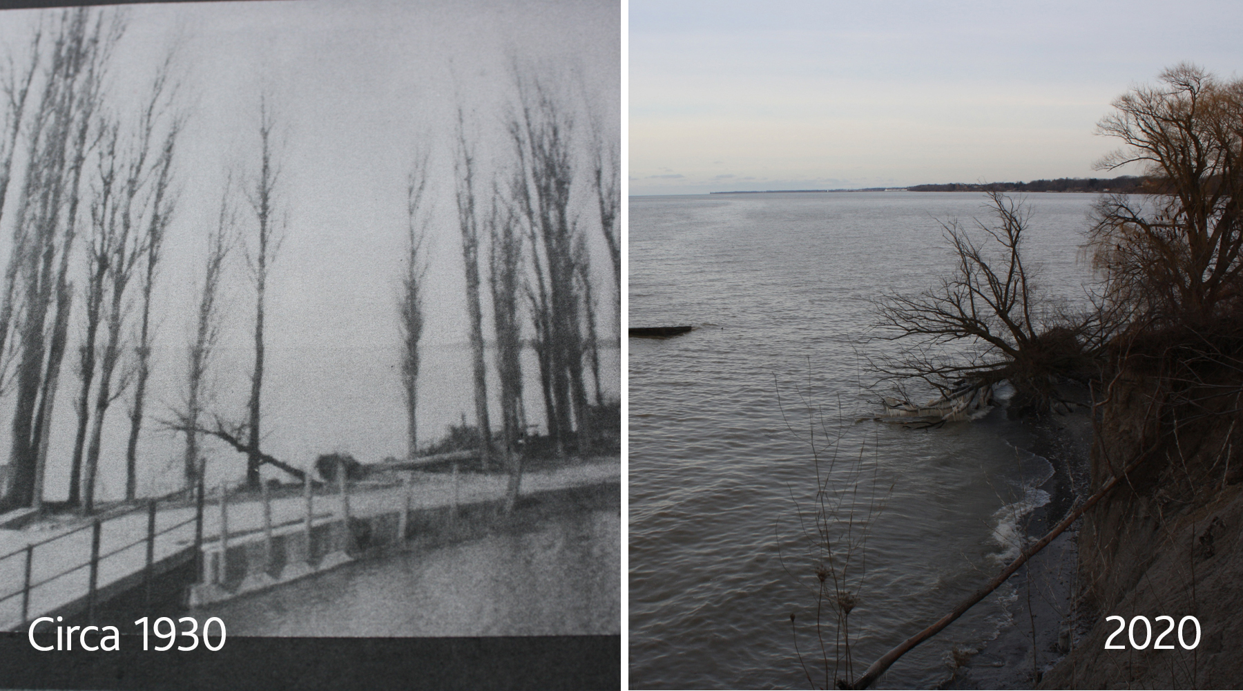
    Coastal communities, such as those along the Great Lakes and St. Lawrence Seaway, have seen changes to their shorelines over a number of decades.

    These changes are the result of several physical (heavy rainfall events, water levels, ice cover) and human-induced (land use change, shoreline protection measures) factors. Although coastlines are dynamic, meaning they are meant and expected to move and change, stretches of the Lincoln coastline are showing high levels of erosion even though they are located in areas not naturally susceptible to erosion. This is a concern that is all too familiar to those who live along the lake and have seen these changes first-hand. Land use changes, such as the addition of a road or a new house along the shore, are partly to blame for these changes. Climate change is also a contributing factor with greater frequency and/or intensity in extreme events, such as heavy rainfall, high winds, and earlier snowmelt.

    Communities must therefore adapt in order to become more resilient to future impacts. It is also important to keep in mind that shorelines will continuously adjust to any changes that take place, whether those are natural processes or human activities. With increasing dynamic patterns of the shores, local residents and governments must have an understanding of the history of the coastline. Knowing what areas of the coastline are more susceptible to erosion and what may have caused these changes can help inform coastline management strategies to maintain shorelines and better protect against these changes.

    MEOPAR Researcher and Brock University Master of Sustainability student Meredith (DeCock) Caspell recently completed a thesis project with the aim of analyzing coastline changes in the Town of Lincoln from 1934 to 2018 using historical air photographs. Physical and human-induced factors were then investigated as possible drivers of these coastline changes. The results of the research highlight the changes over time to several areas of the Lincoln coast that may be more vulnerable to erosion. It also posits patterns to help explain why these changes might have occurred. For example, higher erosion rates occurred between 2015-2018 compared to the other time frames. This could possibly be attributed to recent storm events impacting the coastline in certain areas, including the section of the coasts located near creek outlets such as 30 Mile Creek.

    Caspell combined these photographs with historical maps and commentary to create the interactive ArcGIS StoryMap known as “If Coastlines Could Talk: A Story of Lincoln, ON.”  A StoryMap is a webpage that tells a story through pictures, maps, and words. In this case, it tells the story of the changing Lake Ontario coastline in the Town of Lincoln. To discover these historical changes, see time lapse videos of the coastline changing over time and other interesting visuals, and explore ideas for how we can move forward using a collaborative approach, you can visit the StoryMap on MEOPAR’s website.

    The research team would love for you to share the StoryMap with interested friends and neighbours and to then provide your feedback and reactions directly to the team. You can submit your feedback anytime via email, at [email protected], or you can drop in to one of our virtual sessions to talk directly with one of the research members. These virtual events will take place on Wednesday Oct. 14 and Thursday Oct. 15, from noon to 1 p.m., and on Saturday Oct. 17, from 3 to 4 p.m.

    These events are free and open to the public, but registration is required. Please email [email protected] to register and for event connections details.

    For more information, please visit MEOPAR’s Community Outreach Events webpage.


    Categories: MEOPAR-Lincoln Blog

  • The importance of living shorelines in the Greater Niagara Region

    In our previous posts, we have discussed the changing water levels of the Great Lakes and how these fluctuations could cause damage to the shorelines, specifically in the Niagara Region. To minimize the damage to these areas, we can utilize adaptation strategies, such as living shorelines, that work with natural processes to protect and sustain our waterfront.

    Living shorelines, also known as natural shorelines, are an adaptation strategy that involves the creation of a natural shoreline rich in vegetation that can develop strong root systems. The naturalization of shorelines often requires minimal maintenance and, although it requires a large up-front cost, is often cost-effective over the long-term.

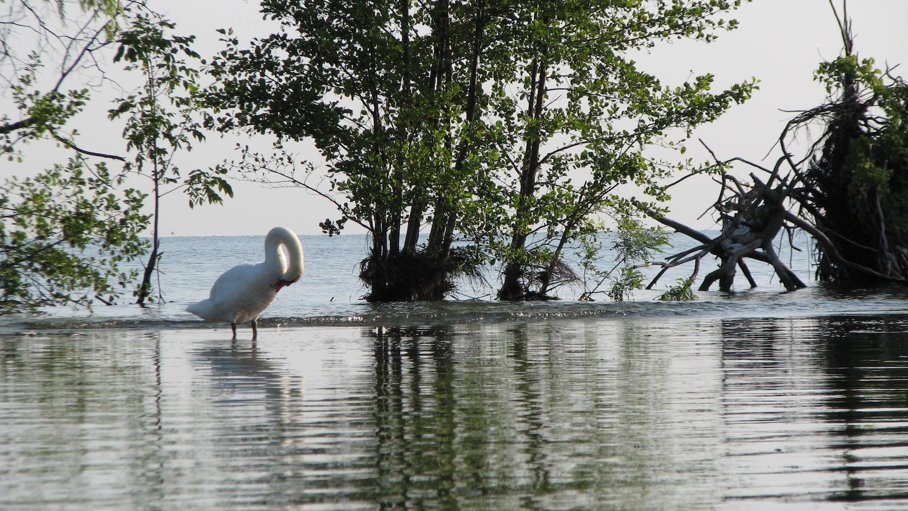
    The vegetation acts as a buffer between the water and land and has many long-term benefits. By adding vegetation to shorelines, the roots of these plants will help hold the soil and prevent erosion while also filtering the runoff that flows from the land into the lake. Filtration of runoff reduces the amount of pollution reaching the lakes and can contribute to fewer algae blooms while also maintaining higher water quality. The buffer that is created from this vegetation also prevents flooding. The plants help to slow the velocity of water, allowing it to absorb into the soil instead of coming on to the shore, preventing further damage.

    The natural beauty of living shorelines can also increase the property value of residential areas and create wildlife habitat. This is beneficial for conservation, as more than 70 per cent of land-based wildlife and 90 per cent of aquatic life depend on shorelines at some point in their lives. The shade that is created from shoreline vegetation can also be helpful in moderating temperatures. This is beneficial for plants as a lower temperatures equates to lower levels of water evaporation and healthier plants overall.

    While there are many benefits that can be provided by a living shoreline, it is important to ensure proper planning is undertaken before creating this naturalization. It is essential to both determine the conditions of your land as well as create a layout of your proposed changes to ensure that the area is being used to its full potential. Determining the condition of your land can be done by first looking at any existing vegetation (or lack-there-of) on the property. By determining what existing vegetation is already growing along the shoreline, you can determine things such as the levels of water or moisture in the area, the sun-to-shade ratio, as well as the soil type. This will allow you to plan which new vegetation would be successful for planting in your natural shoreline. You don’t need to be an expert in plant identification to do this, either, as there are many resources available to assist you, such as the Ontario Native Shoreline Plants website. You can also refer to a native plant supplier, who will be able to tell you which plants are most suitable for your property. They will also be able to tell you how, and when, to properly plant each species.

    Shoreline change and water level fluctuations are inevitable; however, there are many ways we can help to prevent the damage in these areas. Make sure to check out our next blog, where we will be highlighting a research project that reveals key areas of concern along the Lincoln coastline using maps and photographs.

    The researchers involved with the MEOPAR project are working to raise awareness about the impacts of climate change and how communities can effectively adapt, and increase resilience, to these changes. Follow along with our blog every week (written by researchers Liette Vasseur, Meredith DeCock-Caspell, Bradley May, Pulkit Garg, Sam Gauthier & Jocelyn Baker) to learn more about the project and how you can get involved. You can also visit our website at brocku.ca/unesco-chair or email us at [email protected]

    Categories: MEOPAR-Lincoln Blog