News

  • Congratulations to Senanu Kutor on the successful completion of his MA in Geography MRP

    The Department of Geography and Tourism Studies would like to extend congratulations to Senanu Kutor and his committee for the successful defense of his Master of Arts in Geography Major Research Paper entitled ‘Wisdom and cross-cultural interaction: a geographical perspective’ on January 14, 2019.

    Senanu’s research was supervised by Dr. Dragos Simandan and committee member, Dr. Jeffrey Boggs.

    We wish Senanu all the best for his future endeavours!
    Tags: , , , , ,
    Categories: News

  • The meaning of environmental words matters in the age of ‘fake news’

    Reposted from The Conversation | January 10, 2019 5.34pm EST
    Authors: Jessica Blythe, Christine Diagle, and Julia Baird (GEOTOUR, ESRC)

    This week, U.S. President Donald Trump gave a live address on prime-time television where he repeatedly used the words “violent,” “illegal aliens” and “crisis” to arouse public fear. While Trump’s speech was based largely on fallacies, his fear-mongering shapes the national tone and can generate real-world impacts.

    Words matter because they wield power. Words shape our thinking about the world and, in turn, the actions we take. The meaning of words has never been more relevant than now — in the era of “fake news” — when so-called alternative facts abound.

    Environmental words can also be misinterpreted or misused. In the most sinister cases, language can be put to work to promote particular agendas and silence others.

    Remember “beautiful clean coal?” The Trump administration used the term as the backbone for the continued development of the fossil fuel industry. At the same time, it systematically removed the words “climate change” from federal websites, a measure aimed at undermining climate action.

    Power can be expressed through environmental buzzwords. They are used to influence policy direction, funding and produce norms that become entrenched in their meaning around the world. Motivated by this idea, our recent research explores the meaning of three environmental buzzwords — resilience, sustainability and transformation. Meaning influences the way we understand environmental problems and shapes the solutions we prioritize — or don’t.

    The rise of resilience

    Let’s begin with “resilience.” Over the past decade, resilience has increasingly become a rallying cry in the face of climatic change. Resilience has many meanings, from the time it takes to bounce back from a disturbance to more complex interpretations that consider the capacity to persist, adapt or transform in the face of change.

    Evidence shows that individuals, even those who share demographic characteristics or professions, interpret resilience in very different ways. These differences matter and can have implications on real-world actions.

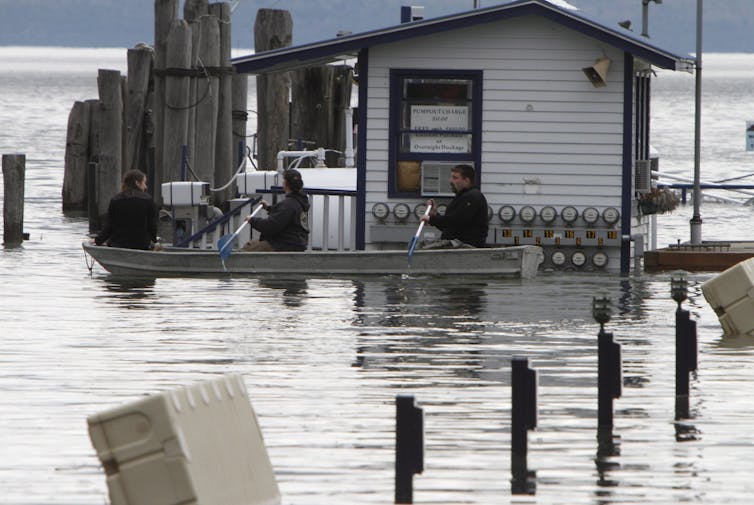
    Flooding of Lake Champlain (seen here) and the Richelieu River in 1991 caused tens of millions of dollars in damage in Vermont, New York and Québec.(AP Photo/Toby Talbot)

    When considering policy and planning related to flooding, for example, understanding resilience as bouncing back can lead to decisions to focus solely on infrastructure investments, while a more complex interpretation may lead to a decision to relocate a vulnerable subdivision away from a floodplain.

    The rise of resilience as a buzzword has also led to its prominence in agendas put forward by organizations looking for funding often without a clear intention or accountability.

    Sustainability for whom?

    The concept of “sustainability” has dominated environmental thinking since the publication of the influential essay “A Blueprint for Survival” in 1972. The notion of sustainability rests upon the idea that we are obligated to future generations and ought to live in a way that preserves natural resources and environments so that our children and grandchildren can enjoy them.

    The underlying idea is that we have the technological and scientific know-how and power to achieve this goal. And this definition of sustainability centres on humans. Asking “what is sustainability and who is it for?” may lead to a surprising shift in this thinking.

    An alternative perspective on sustainability raises new questions: Must we work toward preserving natural environments for ourselves? Is it justified to work toward preserving a species that is harmful to itself and others — like we have been?

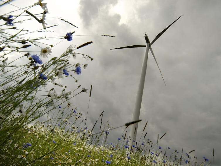
    Is this wind turbine sustainable? Different perspectives may produce different answers. SCA/flickrCC BY

    Privileging the well-being of other species over our own — by significantly reducing our use of highly polluting natural resources — may help to slow climate change, for example. This requires, however, a radical shift in our thinking, displacing the human from the centre of our preoccupations.

    Clearly our know-how has not prevented the acceleration of the environmental crisis. Rethinking ourselves as beings that are deeply interconnected with our habitats and those we share it with, as post-humanist thinkers do, could lead to redefining the notion of sustainability and what constitutes an appropriate course of action. Significantly, this new vision of sustainability may not always favour the human…

    …Continue Reading on The Conversation

    Tags: , , , ,
    Categories: News

  • Congratulations to Sara Epp on her successful PhD defense

    The Department of Geography and Tourism Studies is pleased to congratulate Brock alumna, Sara Epp (BA Geography ’08; MA Geography ’13), on the successful defense of her PhD on November 10, 2018. More information about Dr. Epp’s PhD research is available below.

    Understanding the Multifunctionality of Small-scale Family Farms and the Impacts of Land Use Policies on this Farm Structure

    This research analyzes the resilience of Old Order Mennonite farmers that have migrated to northern Ontario for agricultural endeavours. Over the past fifteen years, Anabaptist farmers, including Old Order Mennonites, have moved to northern Ontario as raising land prices and limited land availability in southern Ontario has restricted their ability to purchase new land. Northern Ontario, with an abundance of productive, less expensive land, has proven to be an opportune location for many farmers. These farmers have increased access to local food, broadened the productive spectrum of crops and improved food security for many communities. Their economic and social impacts on northern communities has been significant, as has their impact on the broader farm community. While the Old Order Mennonite community has grown in northern Ontario, the factors of their resilience are unknown. This dissertation examined three Old Order Mennonite communities in northern Ontario, utilizing key informant interviews with community members, municipal representatives, provincial staff and non-Mennonite farmers in order to understand the agricultural resilience of Old Order Mennonites. The results demonstrated that agricultural diversification, as well as a strong sense of community and cultural convictions were important factors within their resilience. This research also found that transformation and decline, often viewed separately from resilience, did not weaken the communities but contributed to their resilience.

    Download the full paper here.

    Examination Committee:

    • Wayne Caldwell, School of Environmental Design and Rural Development, University of Guelph, Advisor
    • Chris Fullerton, Geography and Tourism Studies, Brock University, Advisory Committee Member
    • John Smithers, Geography, University of Guelph, Graduate Faculty
    • Ryan Gibson, School of Environmental Design and Rural Development, University of Guelph, Graduate Faculty
    • Al Lauzon, School of Environmental Design and Rural Development, University of Guelph, Exam Chair

    Tags: , ,
    Categories: News

  • Build it and they will ride: Bicycle geography lessons for Toronto

    REPOSTED FROM THE CONVERSATION 
    December 17, 2018 | By Phillip Mackintosh

    To paraphrase urbanist James Howard Kunstler, Toronto city council is sleepwalking into the future. While 21st century Toronto’s shift to multi-modal transportation (public transit, automobiles, feet, bicycles, motor cycles, scooters, and skateboards, among others) is already under way, council stubbornly resists its formal implementation.

    We see the catastrophic results of city council’s inaction — negligence — every week. On Nov. 1, 2018, there were 16 vehicle/pedestrian collisions. This echoed another terrible 24-hour period in October of 2016, when 18 people were struck by motor vehicles. And still another in 2015, with 15 collisions in one day.

    Fatalities have risen from an average of 47 per year (2005-12) to 64 per year (2013-16), a consequence of the increase in people on automobilized streets. So far in 2018, 38 cyclists and pedestrians have died on Toronto streets.

    Part of the problem is that too many city councillors have repeatedly voted against bicyclists, bike lanes and multi-modality in general. One infamous and intractable (and now turfed) councillor said, “I do not believe bicycles should be on roads at all.” How odd. This is not what city councillors thought a century ago.

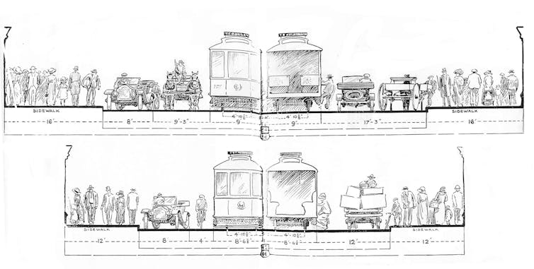
    An early attempt to envision multimodality, by the Toronto Civic Guild (Civic Guild Bulletin, Vol. 1 (June 1912): 10). Toronto Civic Guild, Author provided

    The ‘bicycle-friendly’ council

    At the beginning of the 20th century, Toronto city council embraced bicycles and their riders. City councillors worked with city engineers, bicycle clubs and the Canadian Wheelman’s Association (CWA) to pave streets with asphalt, organize cinder bicycle paths, pave and maintain the so-called “devil strips” (narrow strips of roadway between the opposite running streetcar tracks) and fix the interminable pot holes in the city’s ubiquitous cedar block roads. Council did this to encourage bicycling in a city where “tides of cyclists” used the streets. City councillors, many of whom were cyclists themselves, passed bylaws regulating cycling in 1895. These councillors appreciated that “the thousands of bicyclists of (the) city will hail with pleasure any move on part of the Council” to make the streets accessible to them.

    Why and how does the present city council not see the urban social geographic and economic utility of the bicycle? Likely because it needs a lesson in transportation geography — and it can’t get one soon enough. So here’s a simple, introductory concept: Build it and they will come.

    Traffic generation

    In 1900, Scribner’s magazine published a typically dry civil engineering piece by William Barclay Parsons, the chief engineer of the New York Rapid Transit Commission. In the article, Parsons imparted this transportation planning gem:

    “Whenever a new line has been built in New York, although the first effect may have been — but not always — to draw traffic from a parallel and near-by road, such withdrawal has been but temporary; and in a short time the natural growth of the city, stimulated by the new means of transportation offered, has been sufficient to provide requisite traffic for the new line and increased traffic for the old ones.”

    In other words, each time Parsons built a new subway line, he generated traffic on all the lines.

    This observation was not exclusive to Parsons. In his well-thumbed “Street Pavements and Paving Materials: A Manual of City Pavements” — also published in 1900 — Canadian road engineer George Tillson made a similar contention. Writing about the practices and problems of road paving, he insisted that:

    “It must be remembered that when any one road is selected to be made into a thoroughfare, traffic will be immediately diverted to it and the wear of the pavement abnormally increased.”

    For Tillson, the principle was: Pave it and they will come.

    American road-builder Robert Moses learned these same lessons through his automobility experiments in mid-20th century New York. He intuited that what Parsons was really talking about was traffic generation: the idea that a public transit line or, in his case, a highway, is constructed to increase traffic volume.

    Every time Moses built a road or bridge, traffic invariably choked it, and he would have to build another. This was intentional and he admitted it. As he said:

    “We wouldn’t have any American economy without the automobile business. That’s literally true… this is a great industry that has to go on, and has to keep on turning out cars and trucks and buses, and there have to be places for them to run. There have to be modern roads, modern arteries. Somebody’s got to build them …”

    So Moses and his road-building acolytes did, creating the automobile economy in the process.

    The transportation geography principle that Toronto Council must learn is this: build public transit and you will increase the demand for public transit routes and increase ridership. A public transit culture and economy will follow.

    Choose instead to build roads, and the principle remains the same: you will increase the demand for roads, and increase drivers and driving culture, resulting in an automobile economy.

    It works for bicycles, too…

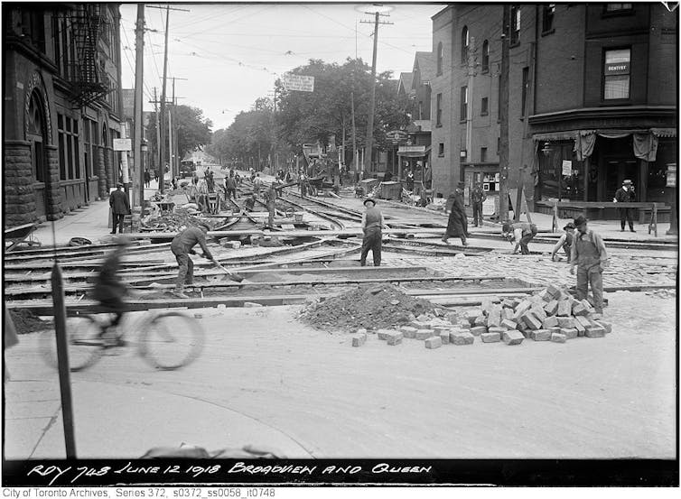
    A cyclist rides past as workers lay down streetcar tracks at the Toronto intersection of Broadview and Queen. June 12, 1918. Arthur Goss/flickr, CC BY

    As Toronto undertook the arduous and contentious process of paving its streets with asphalt in the 1890s, the bicycle population swelled. The CWA estimated…

    Continue reading on The Conversation.

    Tags: , , , ,
    Categories: News

  • New book builds bridge between mobility and social justice

    Having choices about when, where and how to move — and when to stay put — is at the core of mobility justice, a new concept that is developing at the nexus of mobility studies and social justice scholarship.

    A recently published book, Mobilities, Mobility Justice and Social Justice, edited by Nancy Cook, Associate Professor of Sociology, and David Butz, Professor of Geography, explores “the ways social inequities are constituted in relation to mobility,” says Cook.

    The newly established field of mobility studies looks at the differential flows of people, ideas, food and animals, and the related infrastructures that facilitate such uneven mobilities, such as roads, trains, airplanes, fibre optic cables and the internet.

    “Mobility justice is a concept developing in the mobilities literature that examines how differences in mobility capabilities can contribute to social inequalities,” says Cook.

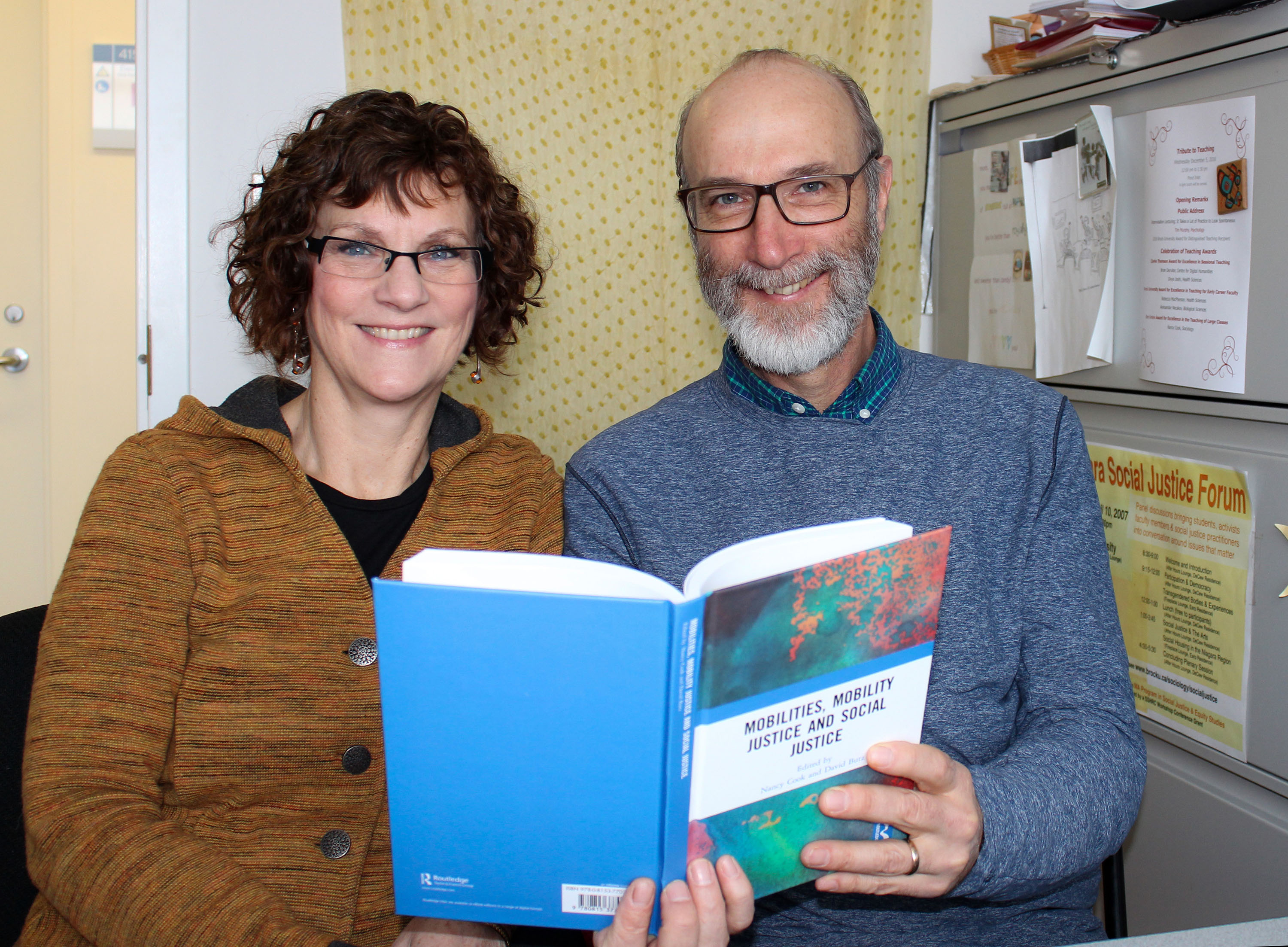
    Mobilities, Mobility Justice and Social Justice, edited by Nancy Cook, Associate Professor of Sociology, and David Butz, Professor of Geography, explores how social inequities are constituted in relation to mobility.

    The topics and regions represented in the book exemplify the “deeply transdisciplinary nature” of mobility studies, she says. “It has put us in contact with a whole different set of scholars from all over the world who we didn’t have access to before.”

    Contributing authors, who come from philosophy, gender studies, communications studies, architecture, transport planning, public administration, geography and sociology, were asked to think about and analyze particular mobility-related injustices using specific social justice concepts.

    “This was to strengthen the justice focus of mobility analyses, and to bring thinking about the mobility-based aspects of injustice to social justice theorising,” says Cook.

    The result is a diverse collection of empirical case studies that illustrate how “different scales, types and facets of mobility interact with particular kinds of social relations to (re)produce inequalities,” she says. Chapters explore issues such as LGBTQ communities’ access to public space, global air travel, ferry service, urban cycling, forced migration, food waste and even tick migration.

    “Most chapters in the book are interested in access or impediments to movement, the way certain sorts of movement are imagined ideologically, and how that shapes people’s access to social justice or shapes inequitable social relations,” says Butz.

    Butz and Cook saw first-hand the social justice implications of mobility infrastructure in their SSHRC-funded research project on the Shimshal Road in Pakistan. During the road’s construction, locals looked forward to a time when they would not have to carry everything on their backs through the mountains. However, the effects of switching from a pedestrian to a vehicular mobility regime have been complicated.

    “We actually see a deepening of particular kinds of inequalities by age and gender,” says Cook. Men and students are “differentially benefitting” from access to this new mobility platform in relation to women and older adults.

    According to Butz, mobility justice is more than simple efficiency of movement.

    “We see social class and social advantage manifested in the way people travel. The trip from St. Catharines to Toronto is different for the person on the bus, in a car or on the Go train,” he says. “These experiences work into people’s identities and understandings of themselves in relation to the world.”

    Mobility justice is as much about staying in one place as it is about access to movement. It’s about the ability to make choices in relation to mobility. “Many commuters would prefer to work near where they live and not feel compelled to move,” says Cook. Infrastructure enables people to live far away from their jobs but relegates them to cheaper suburbs and long commutes.

    Like social justice, mobility justice is most often noticed in its absence.

    “We get at justice by looking at injustice,” he says. But there are movements towards mobility justice, at least for some people. “An accessibility regime at a university is a positive example of achieving social justice for a group through a focus on enabling their mobility.”

    The two say their interest in mobility justice emerged from and is supported by their work with the Social Justice and Equity Studies program and the Social Justice Research Institute.

    “Mobility justice has taken our research in a really new direction which has been very exciting,” says Cook.

    STORY REPOSTED FROM THE BROCK NEWS

    Tags: , , , ,
    Categories: News

  • Geography student wins award for best graduate course paper

    The Department of Geography and Tourism Studies would like to congratulate our current MA Geography student, Jennica Giesbrecht, on being chosen as the 2018 Faculty of Social Sciences Best Graduate Course Paper award. Jennica’s paper, which was submitted to Dr. Michael Ripmeester for GEOG 5P40 (Historical Geographies of Culture  and Power), is titled “Reclaiming Death Care and Negotiations of Culture, Power, and Authenticity.”

    Congratulations Jennica!

    Tags: , , , ,
    Categories: News

  • Geography student wins award for best graduate major research paper

    The Department of Geography and Tourism Studies would like to congratulate Emmanuel Akowuah on being chosen for the 2018 Faculty of Social Sciences Best Graduate Major Research Paper award. Emmanuel’s major research paper, which was supervised by Dr. Chris Fullerton, is titled “Farmers’ Access to Agricultural Information and its Impact on Smallholder Agriculture: A Case Study of the Asante Akim North Municipality, Ghana.”

    Congratulations Emmanuel!

    Tags: , , ,
    Categories: News

  • Geography student studies why some people live on the road

    STORY FROM THE TORONTO STAR | DEC 6, 2018

    Graduate student in the driver's seat of a van she bought for research

    Brock University graduate student Stephanie Murray studied movible communities in a van she bought on Kijiji. Photo by Stephanie Murray.

    When Stephanie Murray, a Geography master’s student at Brock University, set out on a two-month long journey across North America to study nomads and vanlife culture, she didn’t expect to find herself learning to surf, contributing to a documentary film, or being surrounded by a pack of angry stray dogs. But she quickly learned that life on the road is full of unexpected twists and turns.

    An avid traveller, Murray stumbled onto vanlife culture. She was fascinated by the people she met, and quickly realized that although nomads living in vans had been around for years, no one had studied them yet.

    “I knew there was a gap in academia that I could fill,” Murray says. “But if I wanted to truly study this culture, I needed to be able to live and move like they did.”

    “Lola” in the field during her two-month research journey across North America. Photo by Stephanie Murray.

    Using funding from Brock and a Social Sciences and Humanities Research Council (SSHRC) grant, she purchased a used van on Kijiji. Naming it Lola, she converted the vehicle into 66 square feet of living space. Then, over the summer of 2017, she drove to the west coast of the United States to attend “van gatherings,” events where people who live and travel in their vans get together to socialize and support one another. It’s a diverse group, says Murray. “One of the couples I spoke to worked remotely in IT, another couple ran a blog, and one of the other vanlifers was making money from a book he’d written. They’re a pretty talented bunch.”

    She was out to discover their motivation for giving up conventional lives and instead choosing a highly mobile lifestyle. “Our society is oriented towards people who stay in one place, and van nomads help to call that way of thinking into question.”

    “I have encountered so much kindness on the road,” Murray added. “People have welcomed me into their homes and helped me with my van, with no expectation of anything in return. And while the vanlifers I interviewed took up this lifestyle for a variety of reasons, they were united by a desire to choose their own path, rather than the one that’s handed down to them.”

    Murray was thankful that she received the full backing of the University during her time on the road.

    “Brock supported me fully from day one. And that support meant that I was able to do this research in the way it needed to be done — in person, on the road. I lived and moved alongside the people I was studying, and never once did I have to make any compromises that would have hurt the quality of my research. The University made sure I had the resources to do it right.”

    Master's student in the field during trip across north america. Standing in the foggy mountains.

    Research doesn’t have to happen in the lab. Photo by Stephanie Murray.

    Murray’s faculty supervisor and the Graduate Program Director of Geography at Brock,  Dr. David Butz, believed her research was novel and important, given today’s mobile society. Becoming a van nomad herself was pivotal.

    “This research strategy — and life choice — gives her research an unusually strong experiential and autobiographical component, which is rare in ‘mobilities’ research, and which adds to the distinctiveness and potential significance of her research,” says Butz. “We also felt Stephanie’s unusual research project, while logistically complicated, was worth supporting. We were confident about her capabilities based on her history with the University. At Brock, we encourage applications from good students and we’re willing to put funding behind that — and provide them with mentoring to apply for external funding.  Brock can offer lots of personalized attention to students.”

    Research doesn’t have to happen in a lab. There are interesting and exciting things going on around us everywhere, and at Brock University, unique postgraduate research projects in the community are encouraged.

    For her part, Murray is grateful for the support she received from Brock. “This research changed the course of my life, and it showed me that it’s possible to turn your passion into a ground-breaking research project,” she said. “If you have a clear vision of what you want to discover, Brock can help you on that pursuit.”

    Interested in studying in the Master of Arts in Geography program at Brock? Apply by February 15 to start next September.


    Story reposted from The Toronto Star

    Tags: , , , , , ,
    Categories: News

  • New research by geography alumnus looks at fire history in southwest Yukon Territory

    Student in forest taking a tree core sample

    Tyler Prince taking a tree core sample in southwest Yukon Territory. Photo by Kevin Turner.

    New research by Tyler Prince (Brock Geography and Master of Sustainability alumnus), Michael Pisaric, and Kevin Turner was published this week in Frontiers in Ecology and Evolution. Read more below.

    Abstract:

    Previous research suggests climate warming during the current century is likely to lead to an increase in the frequency and severity of wildfire. Recent wildfire seasons in northern Canada generally support these studies, with some of the worst fire seasons on record occurring during the past decade. While we can readily track the spatial and temporal distribution of these events during recent decades using satellite-derived data, historical records of past fire activity are relatively short. Proxy records of past fire activity are needed to fully understand how fire regimes may be shifting in response to changing climatic conditions. A high-resolution fire record, dating back to the early-Holocene, has been reconstructed using a 512-cm sediment core collected from a small lake in southwest Yukon Territory, Canada. Macroscopic charcoal was counted throughout the core at contiguous 0.5-cm intervals. The core was also analyzed for loss-on-ignition and magnetic susceptibility. Fossil pollen preserved in the lake sediment was analyzed to determine vegetation change throughout the Holocene. Macroscopic charcoal analysis indicates an active fire history throughout the record, with 90 fires occurring throughout the Holocene. CharAnalysis indicates an average signal to noise index of 6.2, suggesting the peaks are significant and detectable from the slowly varying background level. Results suggest the fire regime in this region responds to both top-down (climate) and bottom-up (vegetation) factors. Fire return intervals changed in response to shifts in precipitation and temperature as well as the expansion of lodgepole pine into the region. The shifts in precipitation and temperature were attributed to the oscillation of the Aleutian Low pressure system and fluctuations in climate associated with the Medieval Climate Anomaly and the Little Ice Age.

    Access the full paper online.

    Prince, T., Pisaric, M., and Turner, K. (2018). Postglacial reconstruction of fire history using sedimentary charcoal and pollen from a small lake in southwest Yukon Territory, Canada. Frontiers in Ecology and Evolution, online.

    Tags: , , , , ,
    Categories: News

  • GoGeomatics interview: Associate Professor Kevin Turner

    STORY REPOSTED FROM GOGEOMATICS | NOVEMBER 22, 2018

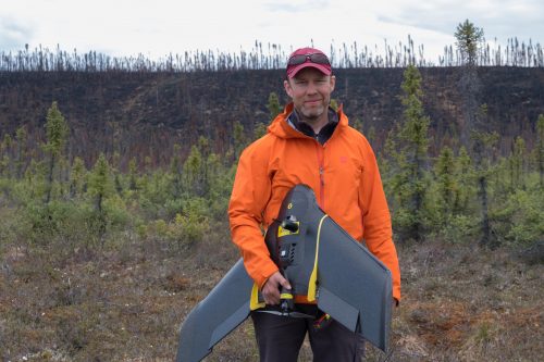
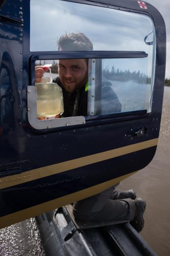
    Kevin Turner working on field research in northern Canada. Image by Brent Thorne

    This installment of our ongoing series on GIS and education in Canada features Associate Professor Kevin Turner from Brock University’s Department of Geography and Tourism Studies.

    Jonathan Murphy: Hi Kevin, and thank you for taking the time to chat with us about your career and your program at Brock. How did your passion for geography start?

    Kevin Turner: I was drawn to nature at an early age. I can trace my interests in geography and the natural sciences to various times starting in Grade 6 when Mr. Wayne Graham (Hamlet Public School, Stratford) put the class in contact with Daphne Sheldrick, the operator of an elephant orphanage in Kenya. While it may not have been geography-focused at the time, I became quite aware of the negative influence people can have on the world and the animals within it. My interest in Geography grew during my grade 11 geography class with Mr. Al Vredeveld at Stratford Central Secondary School. I also had the interests of a couple family members rub off on me. Add in a number of nature documentaries, family camping, a couple David Suzuki books, and some great advice from my high school academic advisor (Mrs. Heather Jesson), and soon I was off to Trent for my undergraduate joint major in physical geography and biology. I had some fantastic profs at Trent who continued to lure me into the natural sciences.

    I was a tree planter during summers in northern Ontario, Alberta, and BC, which continued to build my appreciation for the outdoors. I knew that I wanted to study nature in some way and somehow set myself up to have a career that included working outside in a remote landscape. The motivation for this continued after graduation while hiking and mountaineering in Ecuador and Peru.

    I decided that I wanted to learn more about landscape-scale systems and that building skills in digital mapping and spatial analysis was needed. I received a post-grad certificate in the GIS Applications Specialist program at Sir Sandford Fleming College and got my first ‘career’ job at a geophysical exploration firm out of Guelph, Ontario. I found myself designing projects and surveying in nice places around eastern Canada and the US. In addition to coordinating and conducting the field surveys, I wrote scripts in VBA to design the projects and quality check the data coming in, which I reported to clients.

    I wanted more involvement on the research side of things, especially with water resources, and decided to begin graduate studies in 2007 at Wilfrid Laurier University. The timing was right considering that my new supervisor at the time (Dr. Brent Wolfe) and many other colleagues were beginning a multidisciplinary research program in Old Crow Flats, Yukon, supported by the Government of Canada International Polar Year. It was an incredible experience that presented many opportunities to travel to the north for fieldwork and interact with people of the Vuntut Gwitchin First Nation, who were the driving force of the program. Fast-forward 6.5 years and I’m beginning a position at Brock University where I secured external funding to build on my research in northern Yukon and also Northwest Territories.

    Jonathan Murphy: You were recently promoted to associate professor at Brock–congratulations! What do you teach there and what is your research focus?

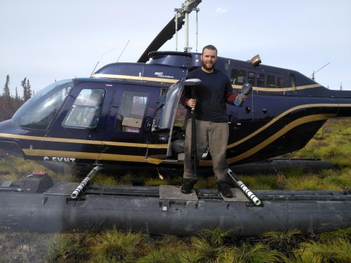
    Graduate Research Assistant Brent Thorne, Image by Kevin Turner

    Kevin Turner: My teaching focus in the Department of Geography and Tourism Studies at Brock is mostly geomatics. We offer a suite of geomatics courses spanning introduction and advanced remote sensing, GIS, cartography, and quantitative research design and methodology. Once students learn to grasp the various concepts, I encourage them to implement creative and critical analysis with datasets and topics that interest them most. I also strive to make them comfortable with using computer programming for automating tasks so they can accomplish more by generating useful customized tools of their interest. We’ve been lucky to have some very strong students come through our programs and it has been rewarding to see them enjoy and take a lot away from our programs.

    Jonathan Murphy:  What is the geography and tourism program like at Brock?  What makes the program unique?

    Kevin Turner: Within the Department of Geography and Tourism Studies, we have a diverse set of streams that students can pursue, which include the following:

    • BA Geography (focus on human geography)
    • BSc Geography (focus on physical geography)
    • Concurrent BA or BSc (Honours) – Geography/ Education
    • Combined Geography majors (e.g., Geography + Biology, Child and Youth Studies, Computer Science, Earth Sciences, Economics, History Labour Studies, and more)

    We offer seven geomatics-focused courses as well as a fourth-year co-op course where students can gain additional hands-on experience in a position of their choosing. The wide-ranging options available provide students with the ability to shape their studies according to their interests. I take this approach with the four geomatics (i.e., mostly GIS and spatial analysis and statistics) courses that I teach. Students learn essential GIS/RS skills for evaluating spatial patterns throughout my courses and have opportunities to implement them within the context of their choice. The aim is to build their knowledge of geography and related fields through enhancing their analytical capabilities. We are lucky to work with the Brock University Map, GIS, and Data Library, which is conveniently located beside our department where students can have access to necessary resources for building their skills in geomatics. I pull a lot from my private sector and ongoing academic research experiences when updating and implementing my courses. I’m happy to report that following graduation, many students who have taken our courses have been quite successful at finding employment and/or additional research programs in their fields of interest.

    Jonathan Murphy:  What geomatics classes or skills are students acquiring by the time they graduate from Brock?

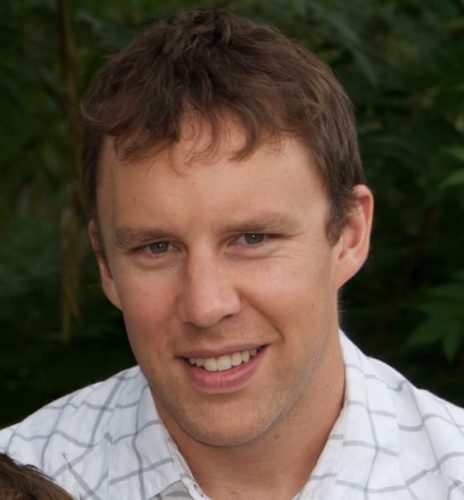
    Kevin Turner. Image by Brent Thorne

    Kevin Turner: Students learn to use many GIS/RS software for their analytical needs and interests. We have many computer labs throughout Brock University with site licenses for ESRI products including ArcMap and ArcGIS Pro as well as ENVI for remote sensing analyses. My courses also include a lot of content focused on open source solutions including R, QGIS, and various integrated development environments. In addition to utilizing databases for spatial analyses (3D, network, spatial statistical, etc.) and geoprocessing, my courses bring in application development so that they can learn to automate or customize their workflow in an effort to eliminate redundancies. This comes from using Python and R programming languages.

    Jonathan Murphy: The program has some interesting aspects to it.  Can you tell us a bit about the weeklong experiential learning exercise in central Ontario for the fourth year students?

    Kevin Turner: We have several ‘experiential learning’ opportunities within our programs. It is geography after all and it is important to get students into the field to get hands-on experience. The Peterborough field course is the longest running one in the department where physical and human geography students get a chance to conduct their research of interest. We offer additional field courses for geography and tourism students to other national and international destinations that have included Croatia, Vancouver, and Chicago. London, England is on the list for next year. I take graduate and undergraduate students who are working on their theses for Geography and Tourism Studies or Earth Science with me to my northern study sites including Old Crow, Yukon, and Yellowknife, Northwest Territories.

    Jonathan Murphy: I understand that 40% of your job is focused on research. Can you describe your research program and how you and the students working with you accomplish it?

    Research Assistant Brent Thorne. Image by Kevin Turner

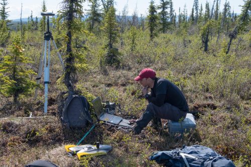
    Kevin Turner: My research program focuses on tracking climate-induced landscape changes and the associated responses of lakes and rivers in northern Canada. For example, the changes that myself and the people of Old Crow, Yukon have observed include an increased frequency of lake drainage, shoreline permafrost thaw slumping (i.e., landslides), shrub vegetation proliferation, and fire. Taking inventory of these phenomena requires the use of available remotely sensed data products and multispectral imagery we collect using unmanned aerial vehicles. Other datasets are coming from airborne campaigns of the NASA Arctic Boreal Vulnerability Experiment, which I am affiliated with. We also sample water and sediment from lakes and rivers, which undergoes a suite of water chemistry and isotope analysis. This information provides an indication of how the landscape changes have impacted water quality, hydrology and carbon export over multiple temporal scales.

    Geomatics tools are essential at all stages of the research process including data acquisition, processing, analysis and integration of final catchment map layers (e.g., ground conditions, land cover type, ground temperatures, etc.). We also identify where lakes and rivers across the study sites are more vulnerable to being impacted by changing climate and landscape features. The overall aim is to provide key insight required for predicting how these places will respond to future change and how that will impact downstream environments.

    Managing a northern research program in a southern Canada university can be a challenge. However, it is a chance of a lifetime for the students to venture out to important remote Canadian landscapes and work with stakeholders, including those who want to learn about the spatial patterns we see in their traditional territories.

    Jonathan Murphy: Thanks for taking the time to talk to the GoGeomatics community.  We hope to see you and your students at our monthly GoGeomatics socials in Niagara!

    STORY REPOSTED FROM GOGEOMATICS

    Tags: , , ,
    Categories: News